Landform Sediment Assemblages in the Upper Mississippi Valley, St. Cloud to St. Paul, for Support of Cultural Resource Investigations
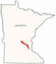
Map of project location
Prepared
for:
Minnesota Department of Transportation
Prepared by:
Edwin R. Hajic
Edited by:
Curtis M. Hudak
Foth Infrastructure and Environment, LLC
June 2002
- Report Text
- Appendix A: Map Unit Field Code Key Table
- Appendix B: Upper Mississippi Valley Core Descriptions
- Appendix C: Macrobotanical Composition of Potential Radiocarbon Samples
Figures (PDF)
- Figure 1: Location of the upper Mississippi Valley project area
- Figure 2: GIS coverage of the Mississippi Valley, St. Cloud to St. Paul
- Figure 3: Vertical aerial photograph illustrating braided stream and braid bar pattern
- Figure 4: Longitudinal profile of the Mississippi Valley between St. Cloud and St. Paul
- Figure 5: Vertical aerial photograph illustrating large-magnitude flood channels just downstream from St. Cloud
- Figure 6: Graphic sediment/soil logs of the CPC, LLB, and FMB landform sediment assemblages along a transect containing cores 01ST01-03
- Figure 7a: Graphic sediment/soil logs of the CPC landform sediment assemblage at core locations 01SH01 and 01WI01
- Figure 7b: Graphic sediment/soil logs of the CPC landform sediment assemblage at core locations 01SH01 and 01WI01
- Figure 8a: Graphic sediment/soil logs of the CPCMA landform sediment assemblage along a transect containing cores 01BE01-02 and at core location 01SH03
- Figure 8b: Graphic sediment/soil logs of the CPCMA landform sediment assemblage along a transect containing cores 01BE01-02 and at core location 01SH03
- Figure 9: Graphic sediment/soil logs of the CPCMA landform sediment assemblage along a transect containing cores 01ST04-07
- Figure 10: Graphic sediment/soil logs of the CPC landform sediment assemblage at core location 01ST10
- Figure 11: Vertical aerial photograph illustrating ice block depressions on catastrophic flood surfaces
- Figure 12: Graphic sediment/soil logs of the CD and LLB landform sediment assemblages along a transect containing cores 01ST08-09
- Figure 13: Graphic sediment/soil logs of the LLBMA landform sediment assemblages along a transect containing cores 01SH15-17
- Figure 14: Vertical aerial photograph illustrating a VT2 terrace remnant with relict island braided pattern
- Figure 15a: Graphic sediment/soil logs of the VT2 and VB2 landform sediment assemblages along transects containing cores 01SH04-05, 01SH06-07, 01SH08-09, and 01SH18
- Figure 15b: Graphic sediment/soil logs of the VT2 and VB2 landform sediment assemblages along transects containing cores 01SH04-05, 01SH06-07, 01SH08-09, and 01SH18
- Figure 15c: Graphic sediment/soil logs of the VT2 and VB2 landform sediment assemblages along transects containing cores 01SH04-05, 01SH06-07, 01SH08-09, and 01SH18
- Figure 15d: Graphic sediment/soil logs of the VT2 and VB2 landform sediment assemblages along transects containing cores 01SH04-05, 01SH06-07, 01SH08-09, and 01SH18
- Figure 16: Vertical aerial photograph illustrating a VT1 terrace remnant
- Figure 17: Graphic sediment/soil logs of the VT1 landform sediment assemblage along a transect containing cores 01SH10-11
- Figure 18: Graphic sediment/soil logs of the VT1 and FFW landform sediment assemblages along a transect containing cores 01SH12-14
- Figure 19: Graphic sediment/soil logs of the VT1MA landform sediment assemblage along a transect containing cores 01ST11-12
- Figure 20: Vertical aerial photograph illustrating a Mississippi River segment with straight channel morphology
- Figure 21: Vertical aerial photograph illustrating a Mississippi River segment with meandering channel morphology
- Figure 22: Vertical aerial photograph illustrating a Mississippi River segment with island braided channel morphology
- Figure 23: Vertical aerial photograph illustrating an island with multiple floodplain surfaces
- Figure 24: Vertical aerial photograph illustrating changes in meandering channel width through time
- Figure 25: Graphic sediment/soil log of the FFW landform sediment assemblage at core location 01SH02
- Figure 26: Vertical aerial photograph illustrating a relict spring-fed channel complex that supplied water to a fen
- Figure 27: Vertical aerial photograph illustrating multiple beach ridges surrounding a lake in an ice block depression