Cartographic products
Maps offered
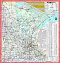
- Official State Highway Map
- Tribal Nations Maps
- District Maps
- County Maps
- Municipality Maps
- Civil Township Maps
- Street Series Maps
- Minneapolis-St. Paul Metro Map
- Trunk Highway System Map
- Construction & Maintenance Maps
- Memorial Highways & Bridges Map
- Control Section Maps
Roadway data
- Enterprise MnDOT Mapping Application (EMMA) - Interactive GIS map application with route information using the latest, updated data
- Seasonal load limits - Map data regarding weight-restricted roadway segments for trucks
- Reference posts - Numbered signs physically located on the side of trunk highways at approximately one mile intervals
- Control sections, statutory routes, and memorial routes - Divided and designated segments of the state highway road system
- Functional classification - Greater Minnesota county and urban area maps
Traffic volume
- Traffic volume maps - AADT/HCADT, ATR/WIM/Wavetronix
locations, retired sites
- Traffic Mapping Application - Interactively explore spatial traffic data
511 real-time traffic maps and cameras
- 511 statewide traveler map - Full-featured option provides access to traffic-related construction reports, weather events, traffic speed information, and static traffic camera reports
Special interest maps
Travel and leisure
- Bicycle maps - U.S., state and county route maps, as well as bike trail detours
- Rest areas
- Scenic byways - Cultural, historic, natural, recreational and archaeological locations and landscapes
- Explore Minnesota travel guides and maps
- DNR recreation and hunting maps
- Aeronautics and aviation
- Airport influence areas - Statewide spatial files, airport maps, MnDOT District reference maps
- Aeronautical chart
- Metro transit trip planner
- MnPASS Express Lanes
Geographic information system
Geographic information system (GIS) is a computer-based tool for mapping, storing, analyzing, and sharing geographically-referenced spatial data.
- MnDOT construction projects
- Enterprise MnDOT Mapping Application (EMMA) - Online application that provides statewide coverage of MnDOT's GIS Basemap data.
- Interactive geodetic basemap - Interactive web tool that allows users to explore geodetic monument data
- MnCORS GNSS Network - Cooperative effort continuously providing survey grade positioning corrections
- Sensor status map
- MnMap - Collaborative GIS information site, supported by ESRI
- Pedestrian asset inventory - Sidewalk and curb ramps
- National Highway System (NHS) - Interactive map and PDFs detailing roadways important to the nation's economy, defense, and mobility
Right of way
- MnDOT eDOCS - Reference copies of maps, plats, permits, plans, survey records, and Commissioner's Orders
- Interactive Mapping and Monitoring application - Web-based map index system designed to help users find right of way, plat and railroad map information
- Right of way map assistance request form
- Freight maps
State Aid for Local Transportation
- Local road project map - Interactive map displaying current and future projects on Minnesota's State Aid highway system, uses Google Maps interface
- County engineers map (PDF)
- County associate members map (PDF)